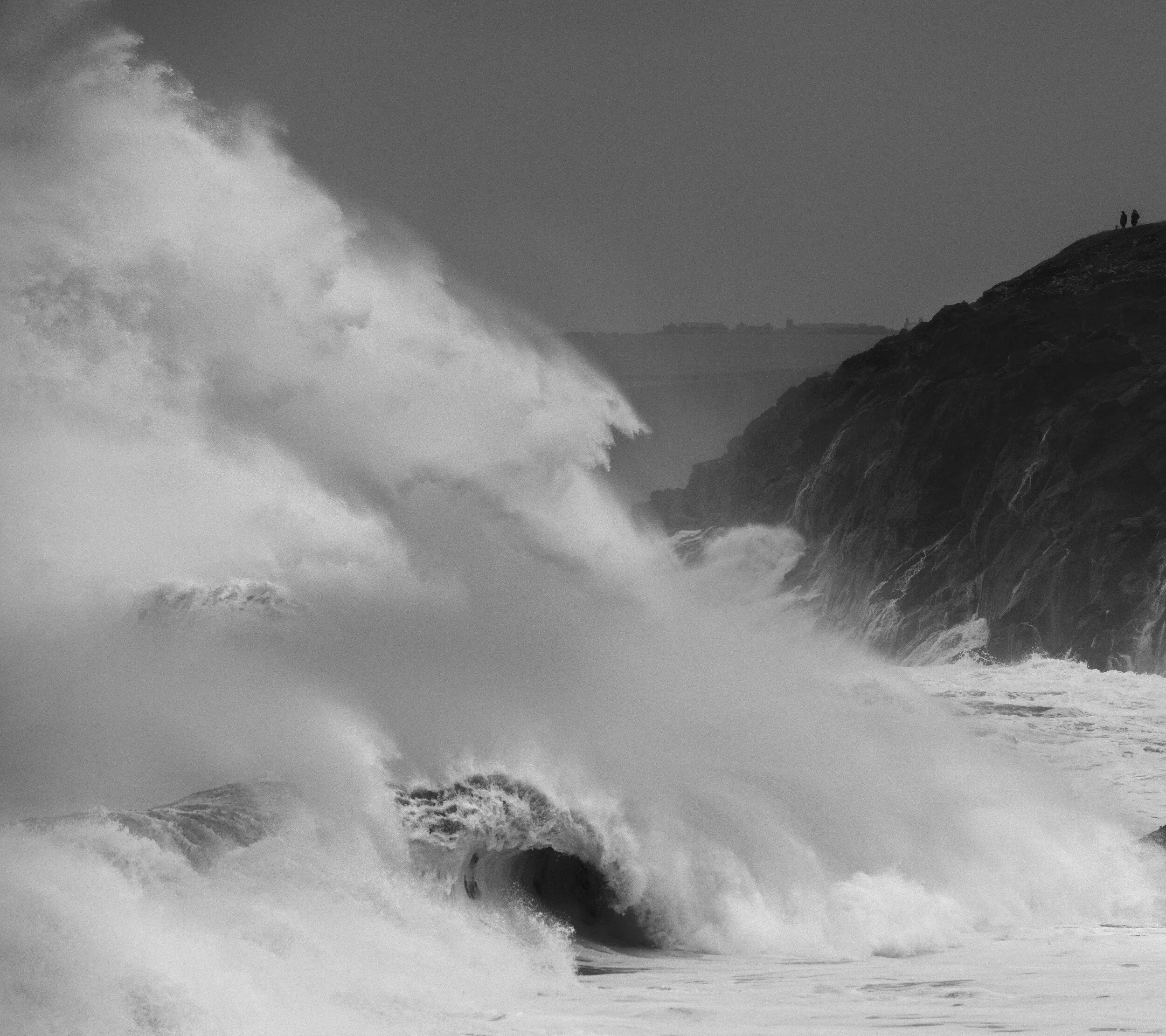


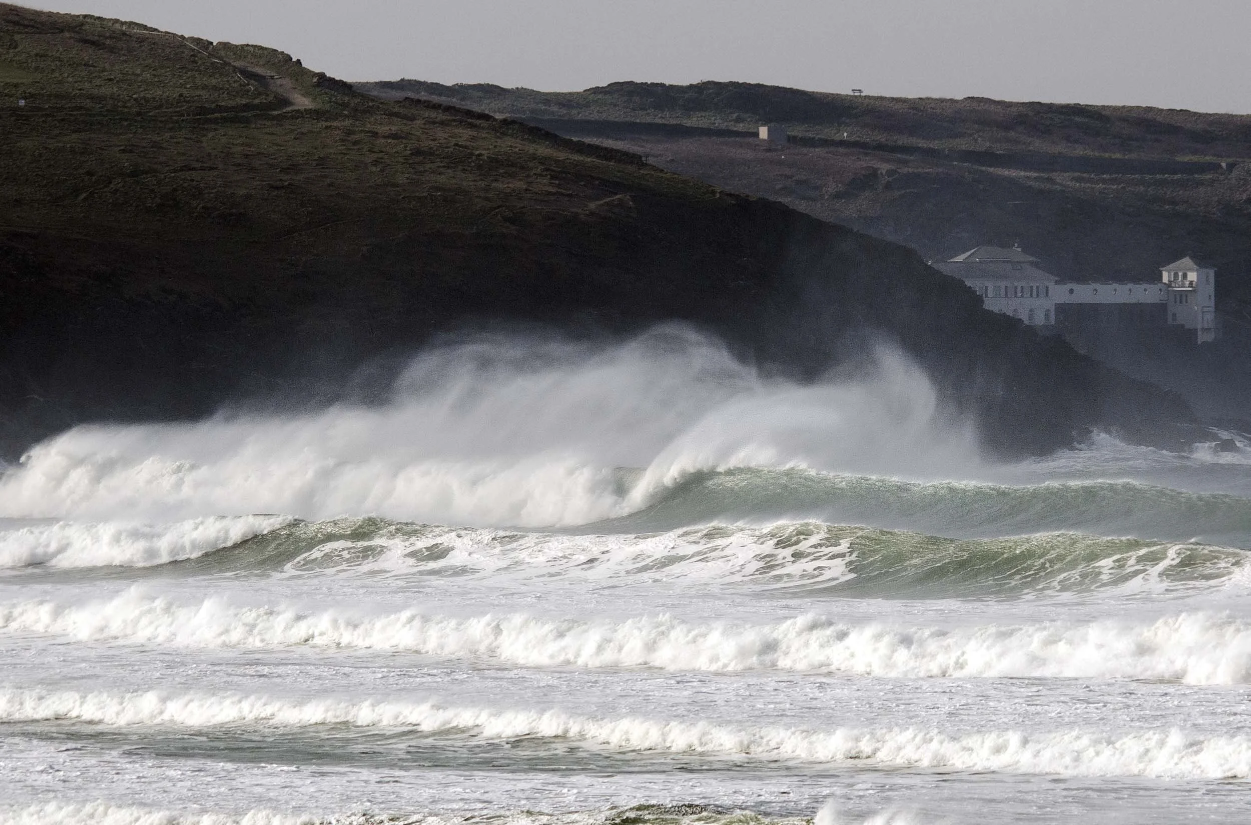
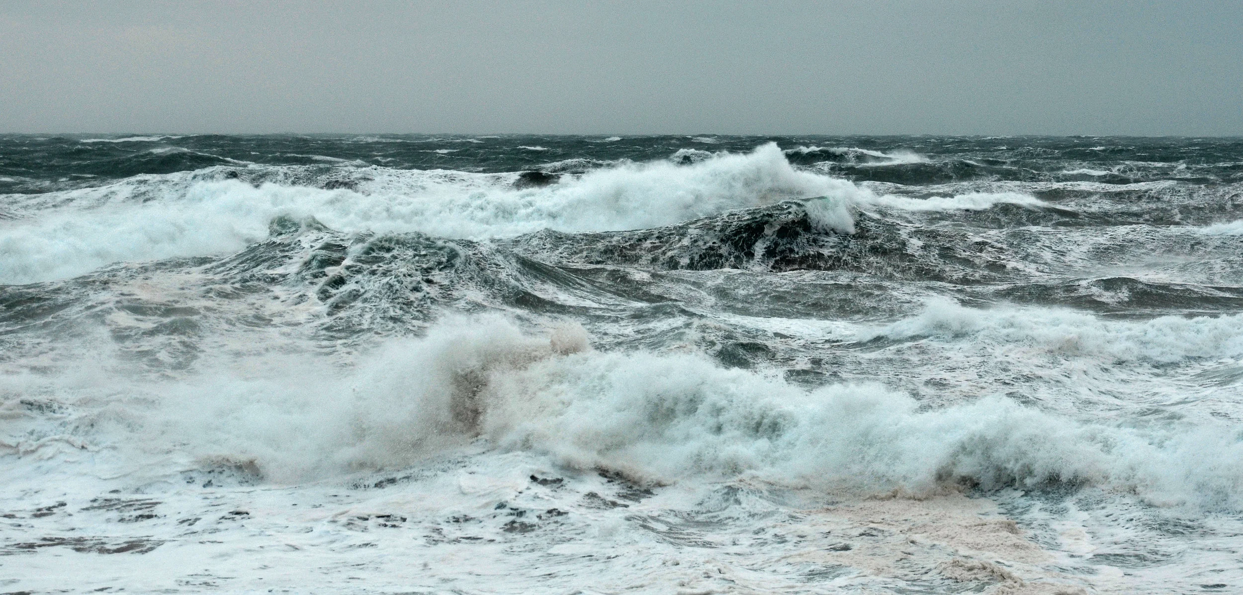
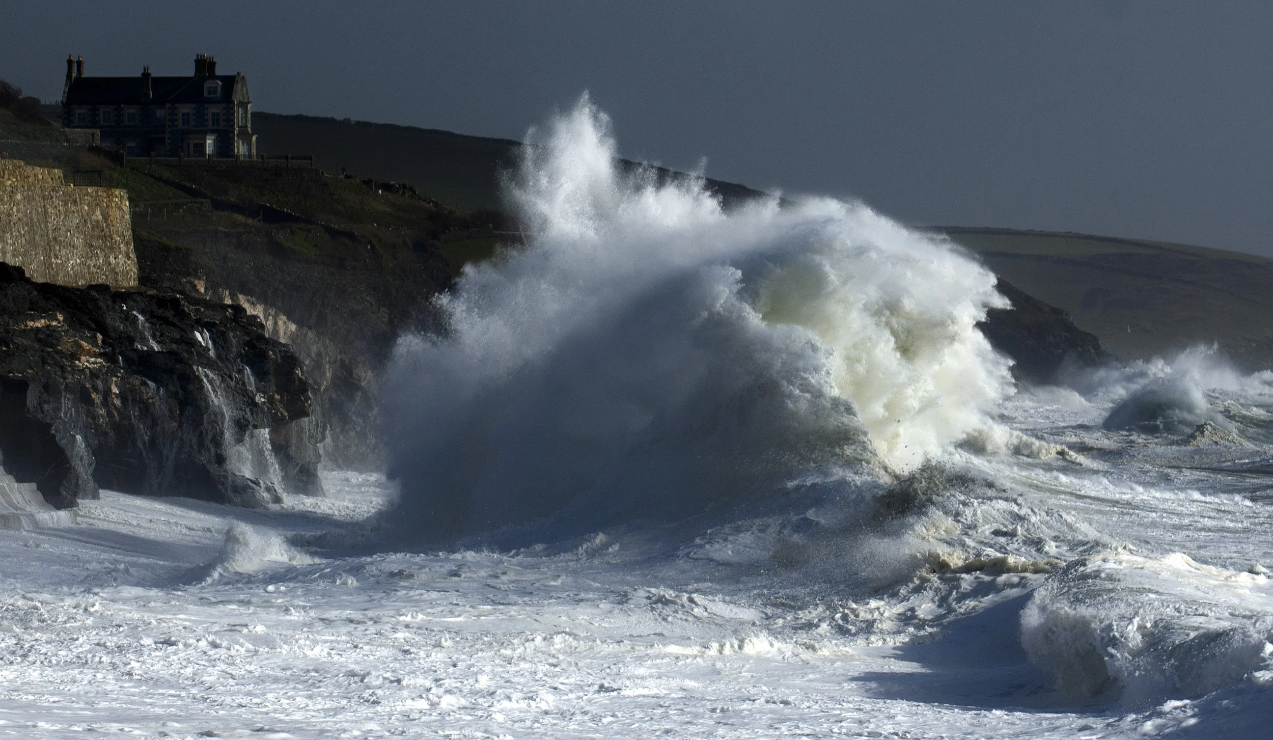
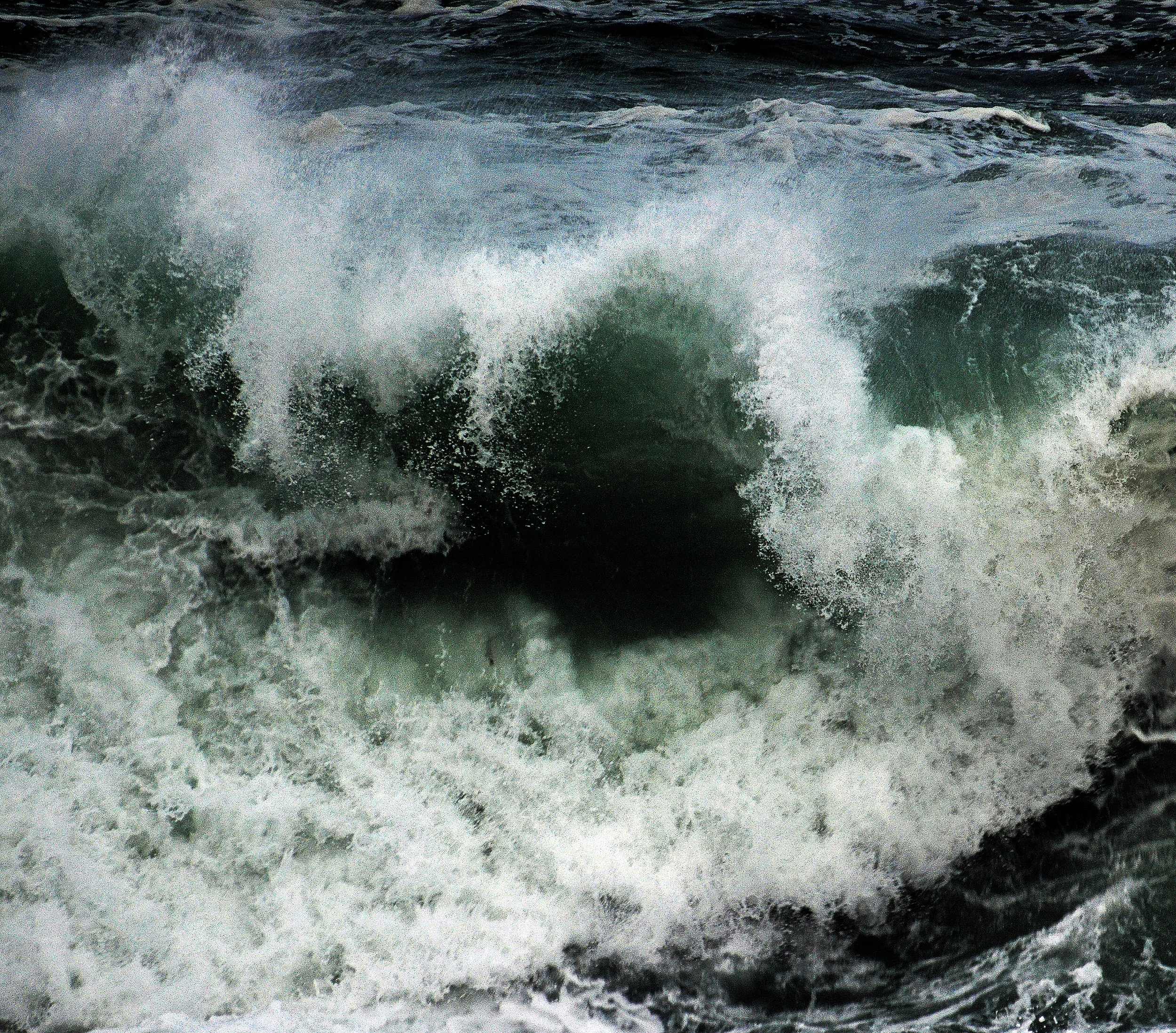
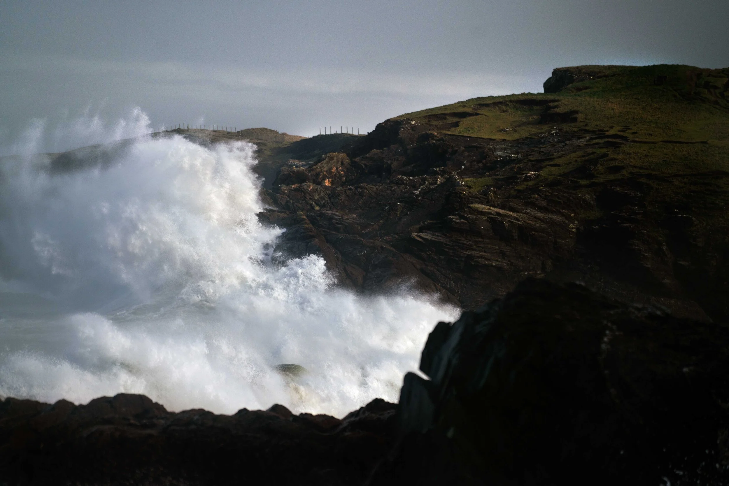
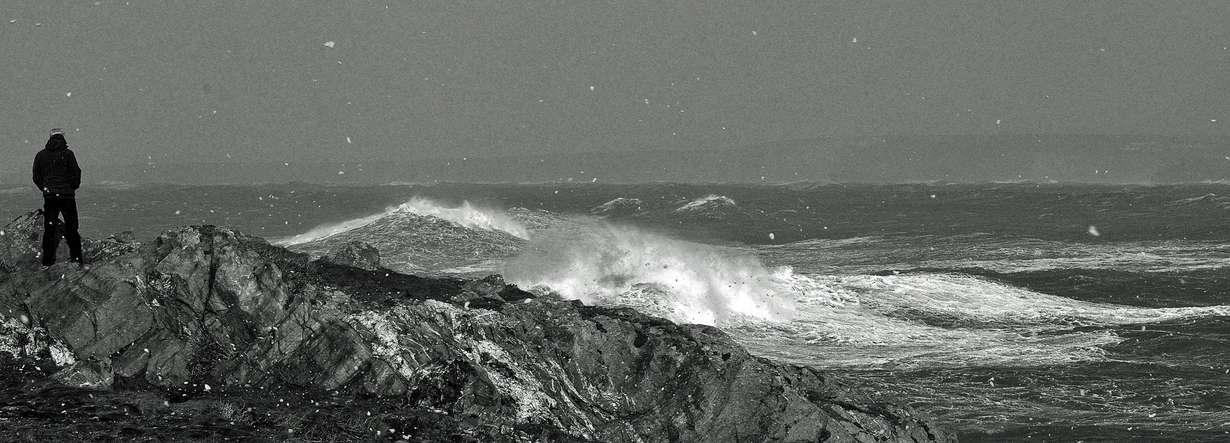

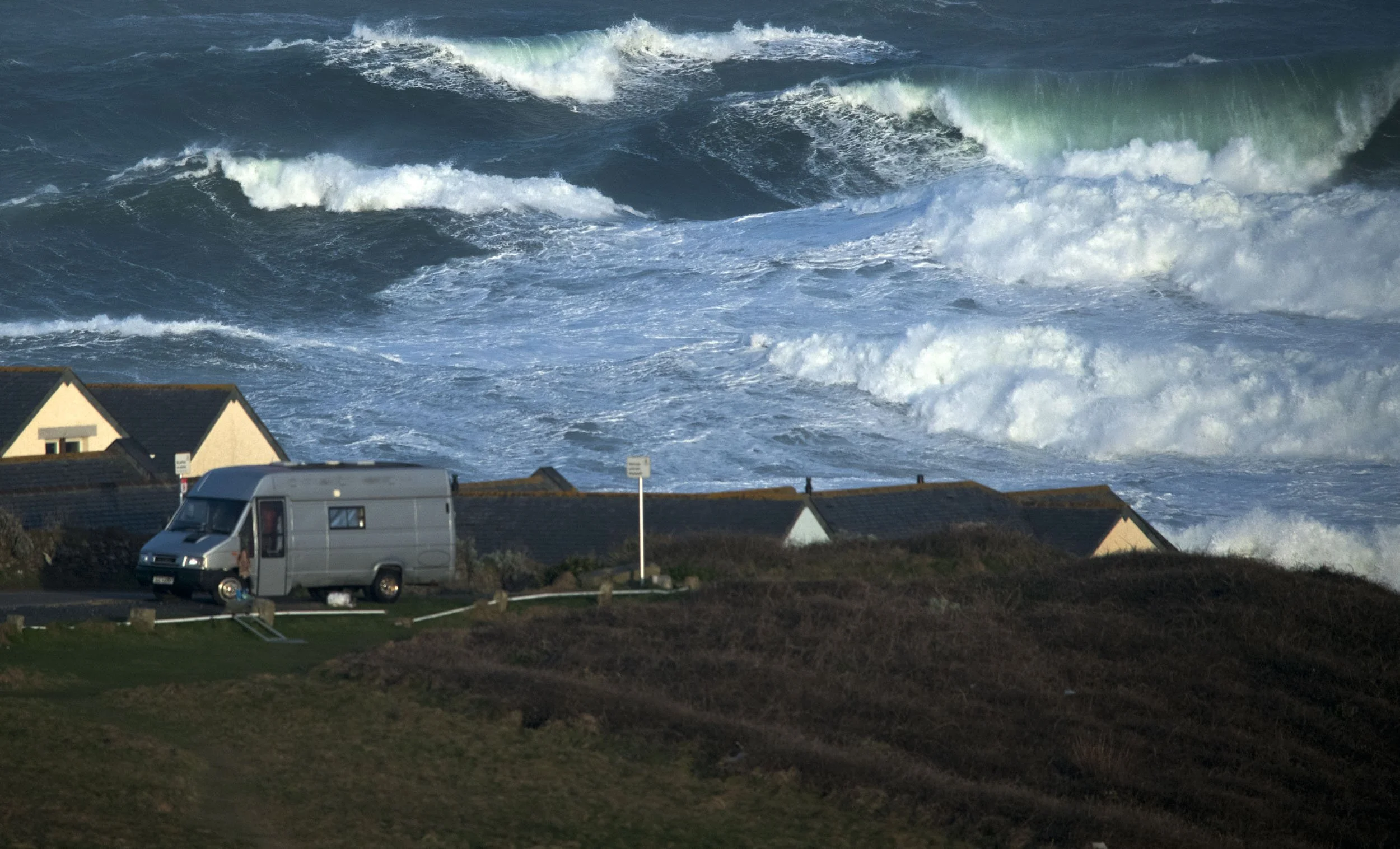
Hurricane Epsilon - 28.10.20. Epsilon was a Category 3 Atlantic hurricane that formed in October 2020. Though it never made landfall, it brought large swells and strong waves across the North Atlantic. On the 28th these waves hit Cornwall. Epsilon didn’t cause much direct damage but it brought with it unusually large surf and dangerous coastal conditions. Interestingly, Epsilon had rapidly intensified despite cooler waters and hostile wind shear. These conditions are unfavourable for hurricanes. This made it one of the fastest-late-season intensifying storms on record. (Picture.North Coast. Cornwall).
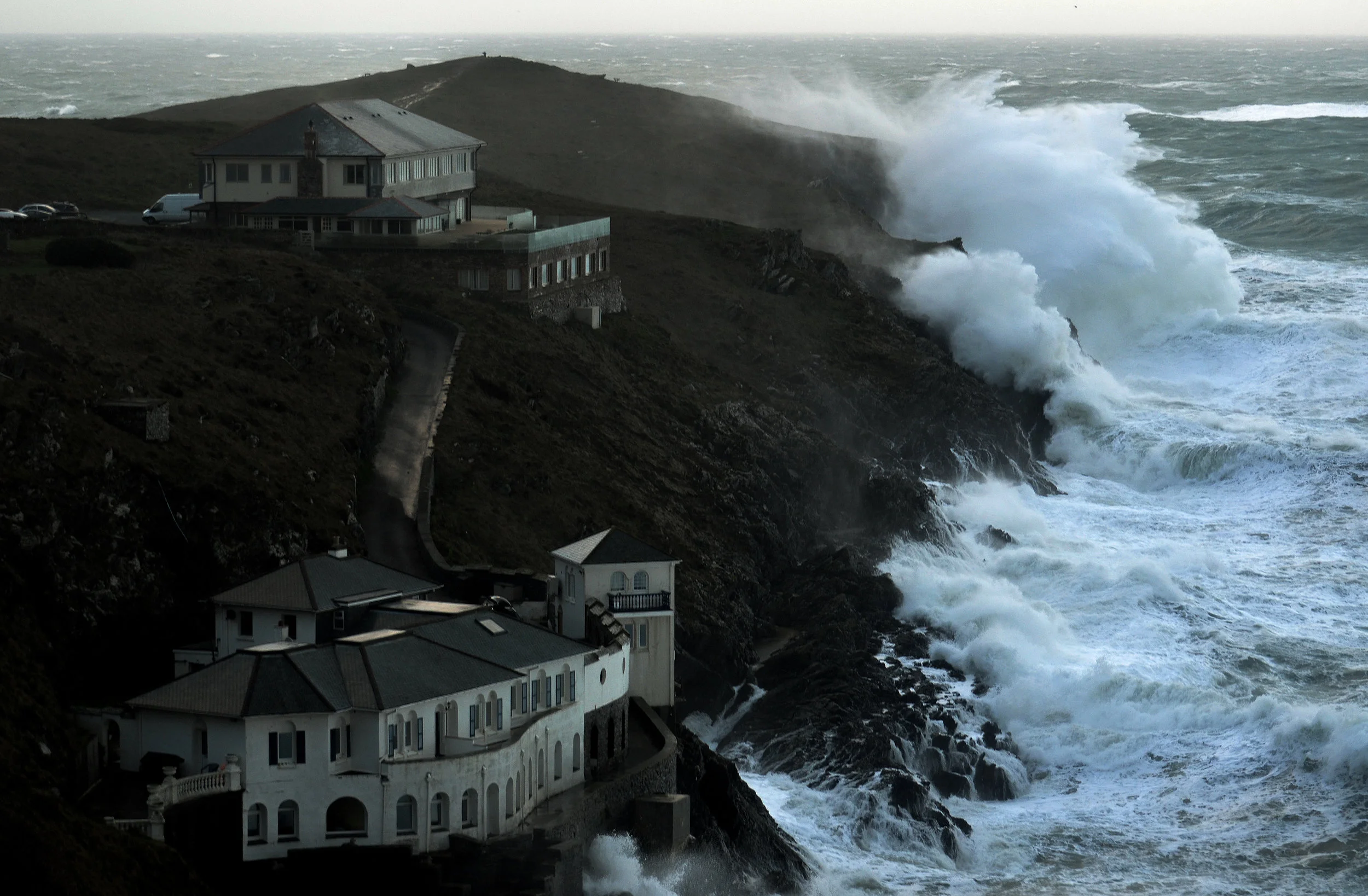
Storm Barbara 28.10.20. Barbara 2020brought moderate rain and wind to parts of southern England, including a yellow rain warning along parts of the Cornish coast. led for 10–15 mm of rain. Around 30–50 mm of rain fell in a short period of time. Gale‑force gusts of up to 65 mph were expected in exposed coastal areas. However no reports of notable damage in Cornwall emerged the storm passed without significant disruption although the ocean lit up! (Picture. Cornwall). (MET OFFICE).
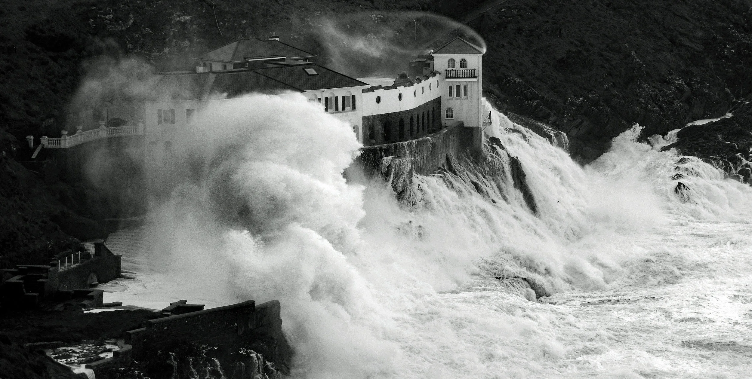
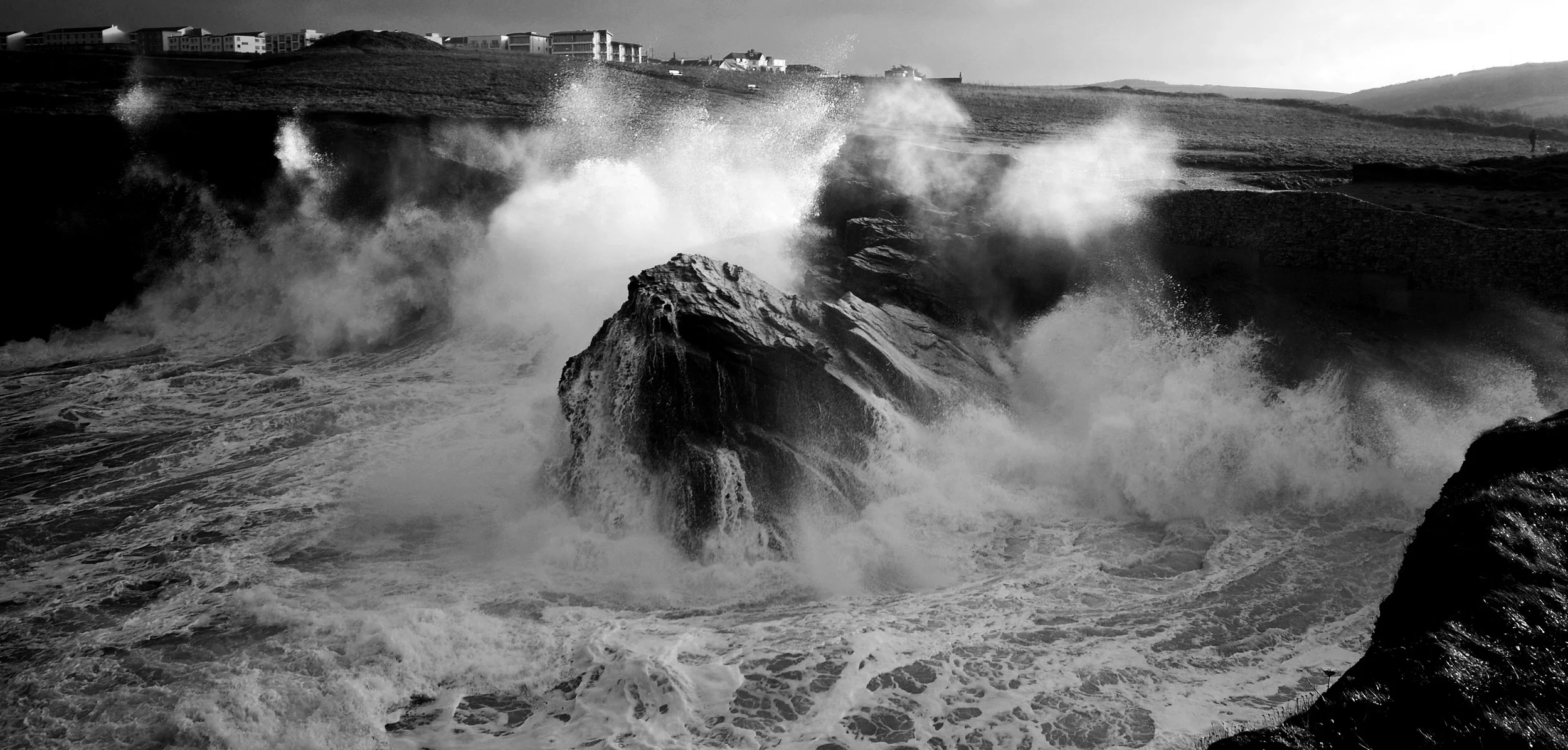
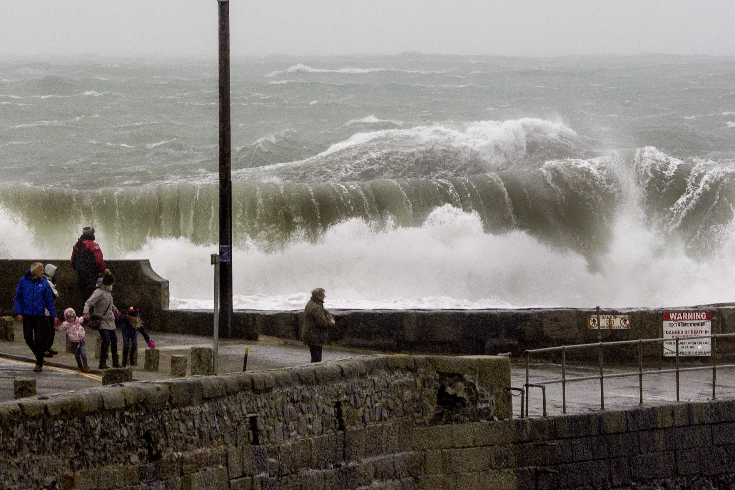
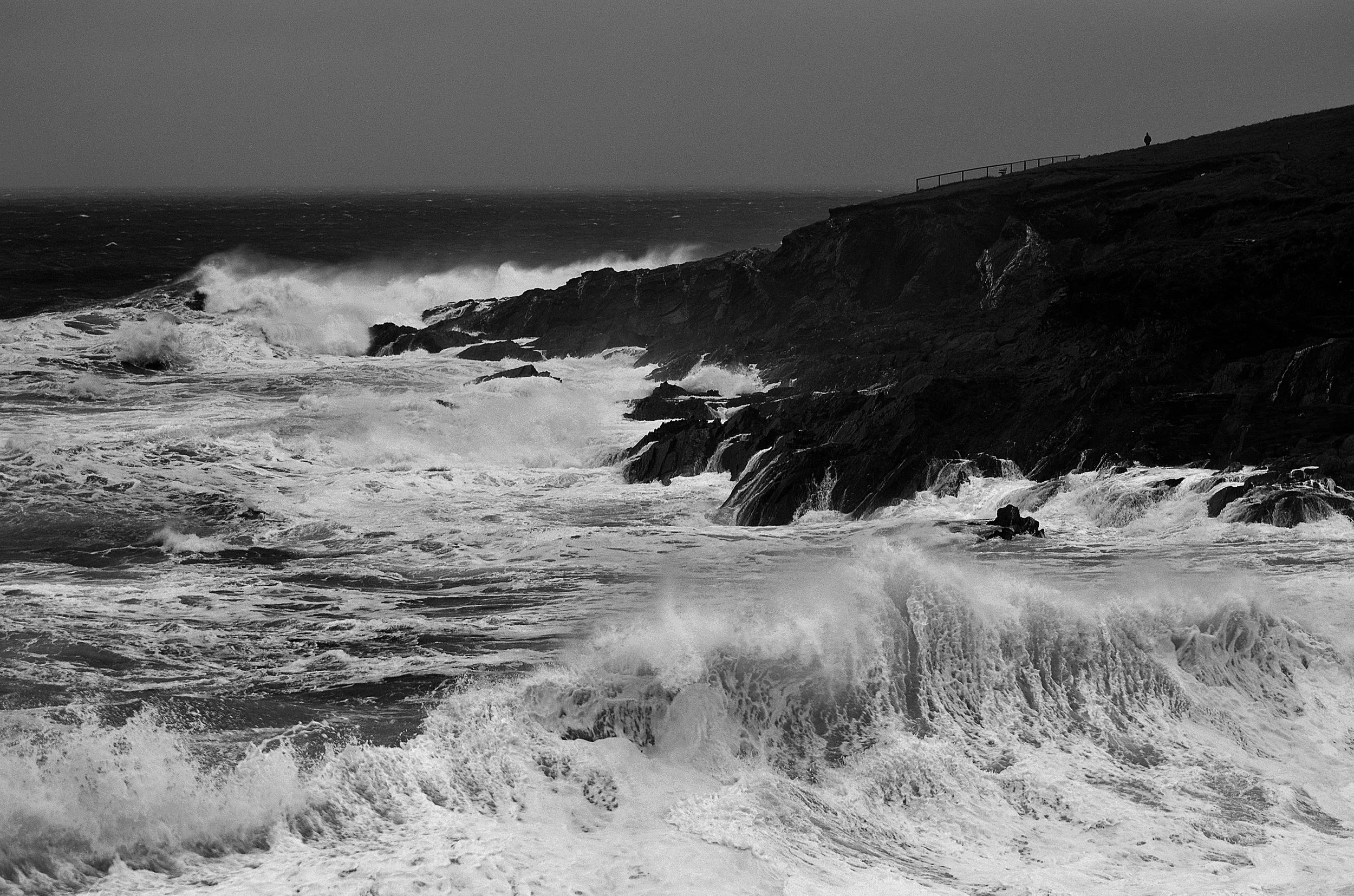
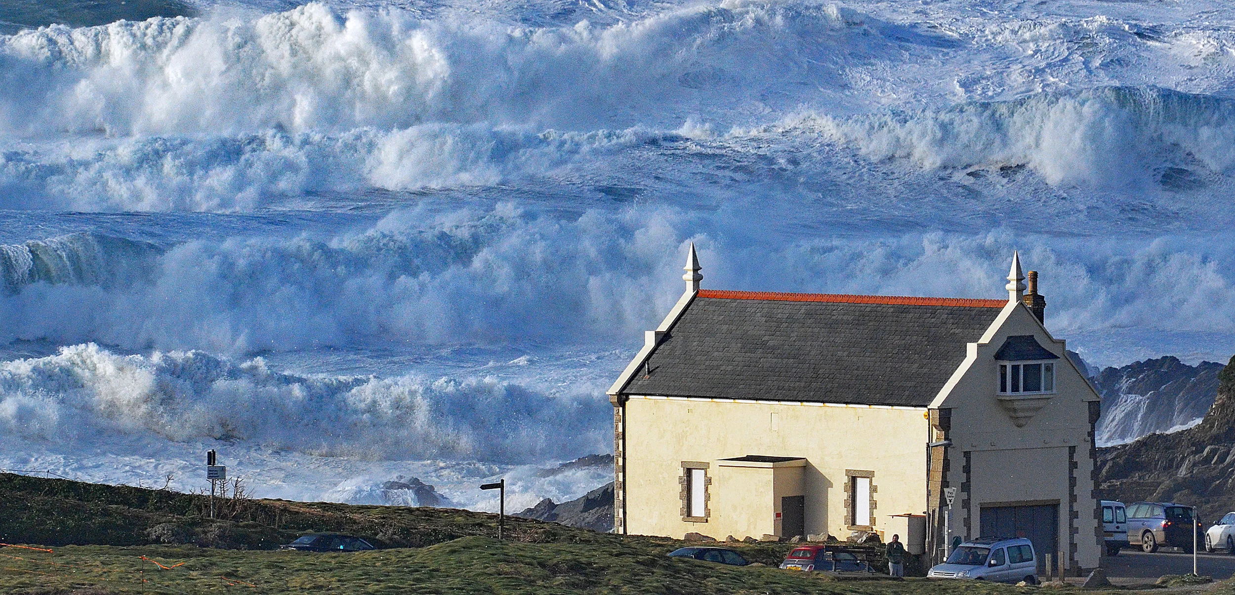
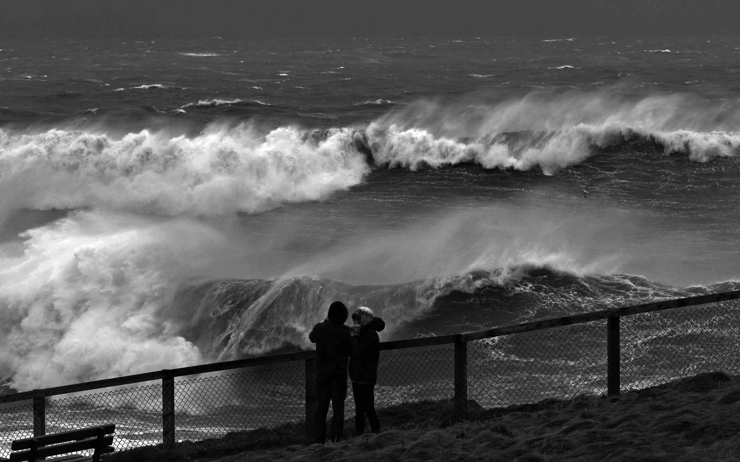
Storm Gerrit - 27-28.12.23. Gerrit hit between December 27–28 2023 and swept into Cornwall under a yellow weather warning, bringing strong winds gusting up to 70 mph and heavy rain. While Cornwall avoided catastrophic damage, an alarming moment occurred in Porthleven, where a massive wave nearly swept a woman and her dog off a harbour wall—prompting coastguard warnings to stay clear of the coastline. Although there were dramatic coastal conditions there was no real damage to major infrastructure. (MET OFFICE). (Picture, Porth Kernow. Cornwall).
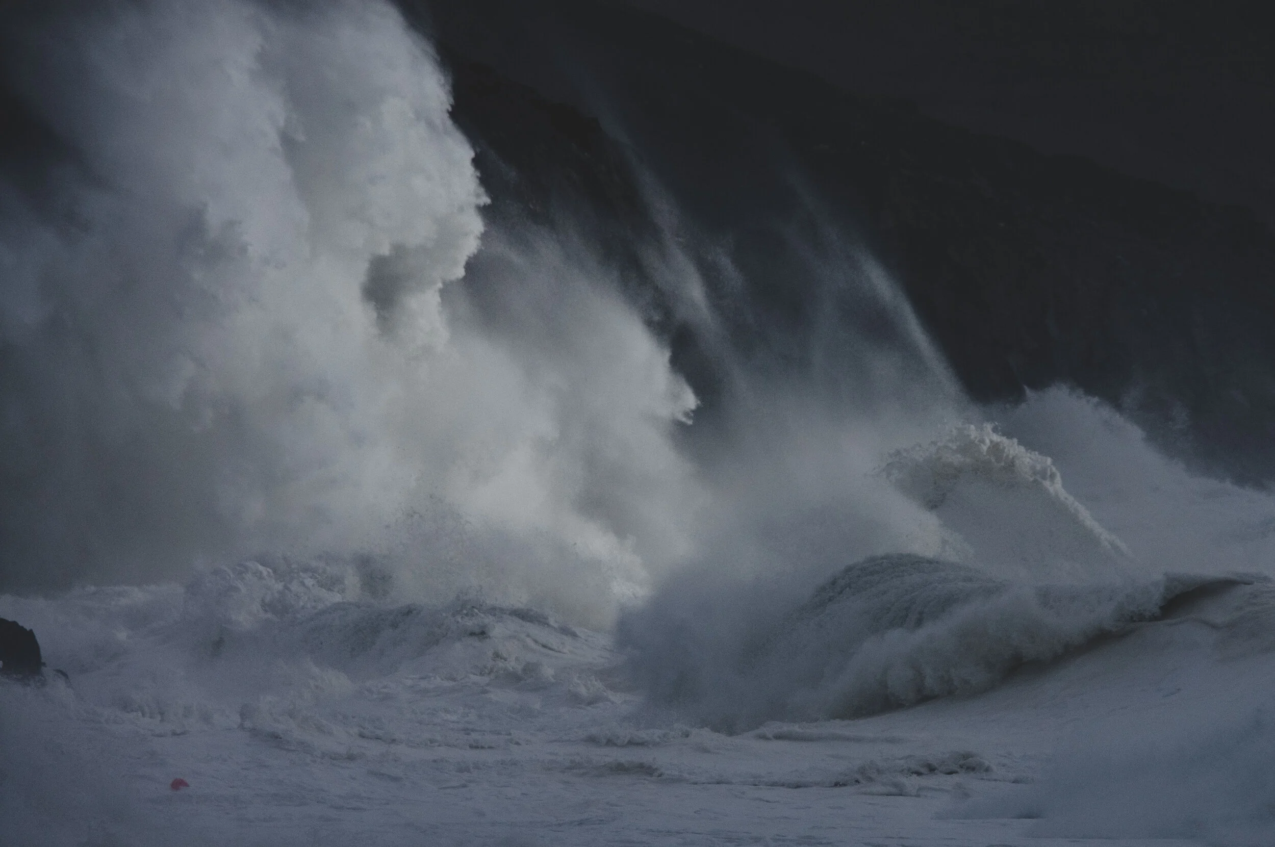
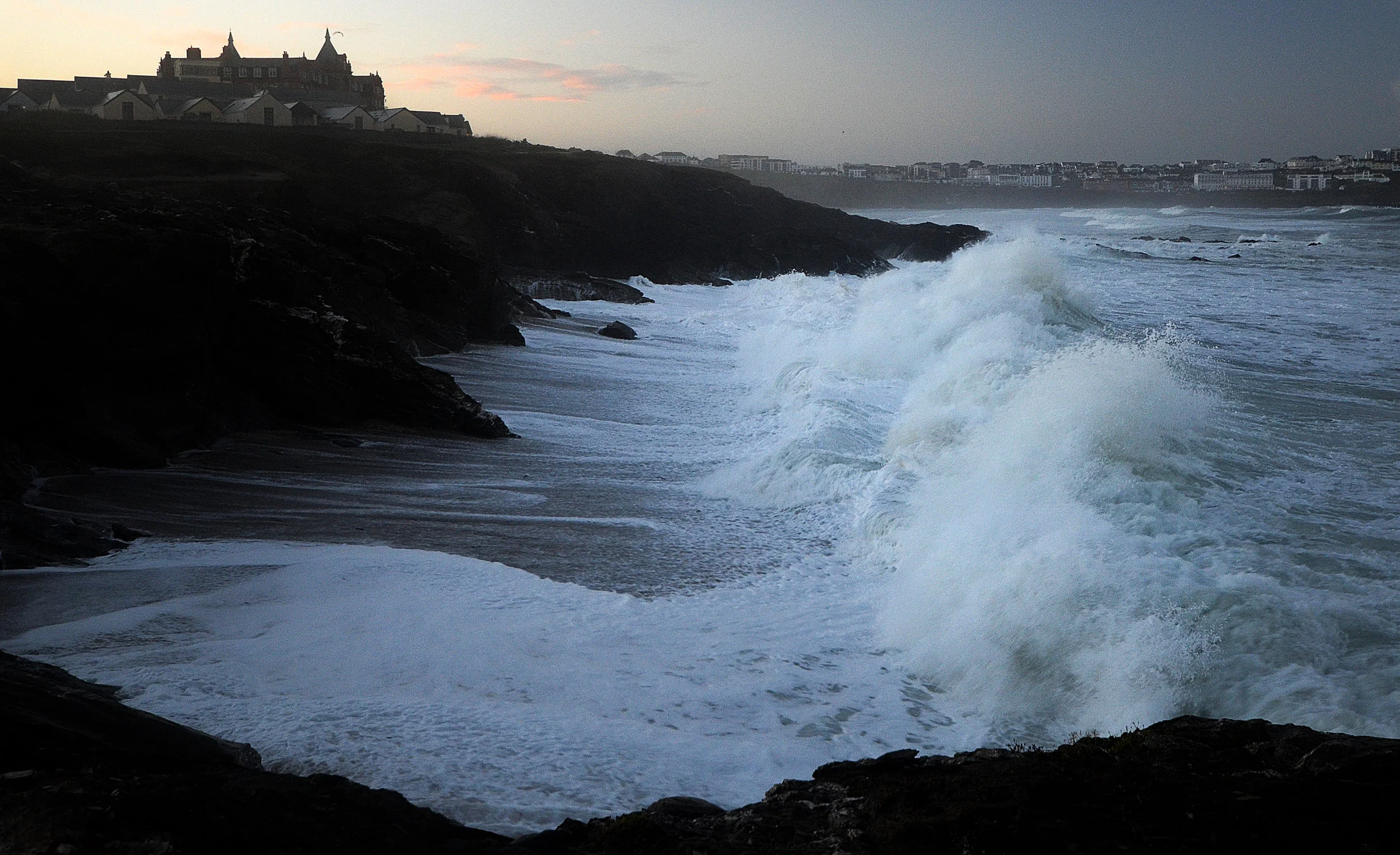
Storm Babet - 18th October 2023, provided a full-force attack on the Cornish coastline. Massive damage was caused by flooding and even seven lives were lost in the United Kingdom. Unusually Babet travelled Northerly and due to this, it was able to gather a massive amount of extra water as it hurtled up the Bay of Biscay. (Picture, little Fistral. Cornwall). (MET OFFICE).
Storm Eunice - 18.02.22 Eunice was a ferocious extratropical cyclone that struck the UK in February 2022. It unleashed a record-breaking 122 mph gust at The Needles, Isle of Wight, the highest ever recorded in England. It caused around £360 million of damage nationwide . In Cornwall, the storm brought widespread destruction with dozens of roofs ripped off houses (including lifeboat and beach structures) hundreds of fallen trees blocked roads and up to 27,000 properties were blacked out by power cuts . Its ferocity, red “danger to life” warnings and with its unprecedented wind speeds made it was one of the stormiest events in decades . (Picture Little Fistral. Cornwall). (MET OFFICE).
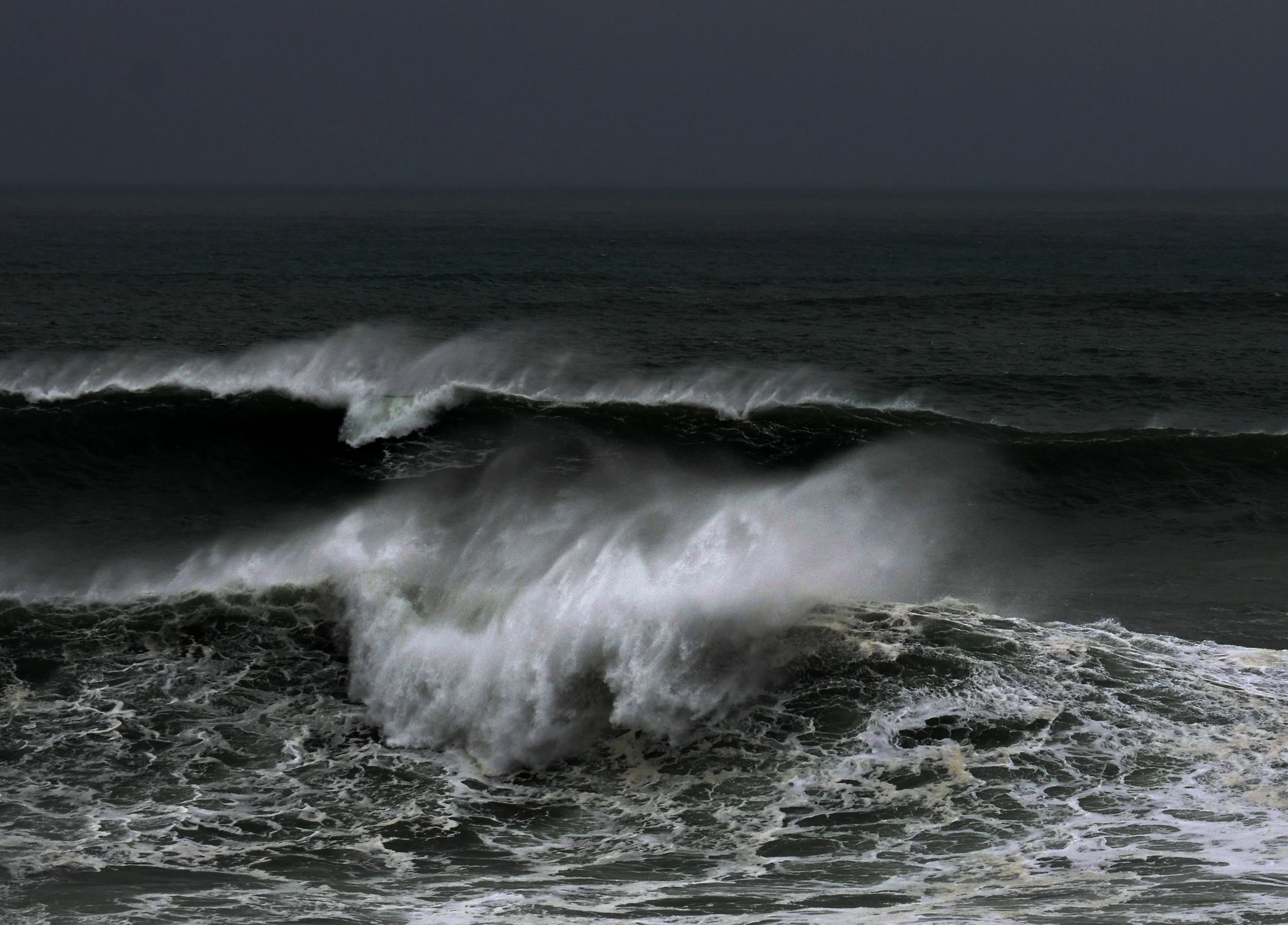
Storm Brendan - 14.02.20. Brendan(2020) was a powerful Atlantic low-pressure system that underwent explosive intensification that turned it into a (“weather bomb”) On the 13th of January it battered the UK and Ireland with heavy rain and strong winds—Gusts exceeded 80 mph across western Britain, reaching up to 87 mph in parts of Scotland, and even higher on exposed coasts. (Picture North Fistral Beach, Cornwall). (MET OFFICE).
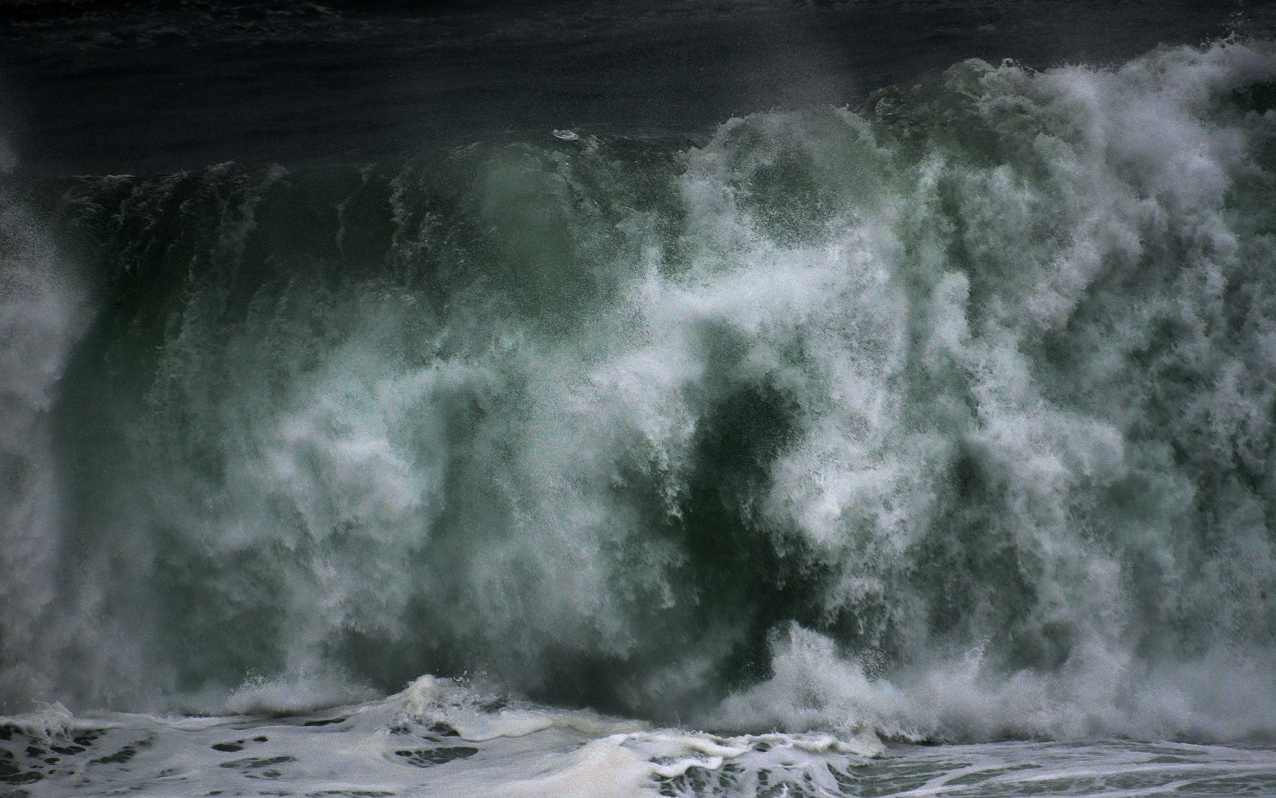
Storm Ciara - 09.02.2020. Ciara (2020) was a powerful extratropical cyclone that swept across the UK on the 9th of February 2020. It brought hurricane force winds of up to 97mph notably at The Needles and widespread disruption in Cornwall. It caused roof damage and lightning struck homes in Par and Penzance. Dramatic coastal waves battered harbours, especially at Portreath where waves towered over cliffs. (Picture, South Coast, Cornwall). (MET OFFICE).
Storm Ciara - 09.02.2020. (Picture, South Fistral Beach. Cornwall).
Storm Jorge - 29.02.20 Jorge (February 2020) was the UK’s third major storm that month, bringing heavy rain, up to 80–100 mm and gusts of 60-70mph as well as snow in parts of Scotland. It helped make February 2020 the wettest month on record for the UK. (Picture, South Coast. Cornwall). (MET OFFICE).
Storm Erik - (2019). Erik the UK’s first named storm of the year, lashed Britain and Ireland on 8th and 9th February with gusts up to 86mph at Capel Curig and 76mph on the Isles of Scilly. It caused tragic fatalities, including a driver crushed by a fallen tree in Devon and a kitesurfer killed on Saunton Sands. The Tamar Bridge was closed to high‑sided vehicles as a precaution. Erik delivered one of the season’s strongest gales and exemplified early‑winter storm vulnerability along exposed coasts. (Picture, Bakers Folly. Cornwall). (MET OFFICE).
Storm Erik - 27.01.2019 (Picture, South Fistral Beach. Cornwall).
Storm Erik - 27.01.2019 (Picture, Crantock Beach. Cornwall).
Storm Diana - 28.11.2018. Diana (2018) was a fierce European windstorm that battered the UK around 29 November with winds up to 80 mph. There was torrential rain and widespread disruption, including power outages to over 40,000 homes and major travel delays. In Cornwall, strong gales and huge waves smashed over sea walls especially at Mousehole. The storm's intensity and dangerous surf earned it "danger to life" warnings for coastal areas. (Picture, Whipsiyderry. Cornwall). (MET OFFICE).
Storm Callum - 13.10.2018 Callum ( 2018) brought intense winds (up to 76 mph in the Isles of Scilly) and torrential rain across Cornwall, powerful gusts felled trees crushing two cars near Truro and cut power to over 1,000 homes, especially in Par and Camelford. Caravans at Looe’s Tencreek Park were smashed and westerly seafronts were pounded by waves. Callum’s rapid intensification to a pressure of 938 hPa marked it as an unusually deep mid-latitude storm. (Picture, Cape Cornwall). (MET OFFICE).
Storm Éowyn - 21.01.25. Eowyn was a powerful extratropical cyclone that ferried explosive mid-latitude storm energy across the Atlantic. It was driven by an exceptionally strong jet stream. In Cornwall, it toppled trees and led to power outages, with brutal gusts reaching 75 mph on the Isles of Scilly. There were road closures and a surge in emergency calls as caravans overturned at Holywell Bay near Newquay. Eowyn stood out for its rare intensity, severe disruption, and far-reaching coastal violence. (Picture, Cribbar Reef, Towan Headland. Cornwall). (MET OFFICE).
Storm Freya - 2019 . Freya struck on the 3rd and 4th of March 2019, bringing strong winds gusting up to 87mph at Sevenstones, Cornwall and heavy rain. Cornwall endured fallen trees, power outages, blocked roads, and dramatic coastal surges, particularly at Porthleven and Penzance. (Picture, Porthleven. Cornwall). (MET OFFICE).
Storm Freya - 22.02.2019. (Picture, Porthleven. Cornwall).
Storm Freya - 22.02.2019 (Picture, Porthleven. Cornwall).
Storm Freya - 22.02.2019 (Picture, Newquay Bay. Cornwall).
Storm Freya - 03.03.2019 (Picture, St Agnes. Cornwall).
Storm Deirdre - 15.12.2018. Deirdre (2018) brought strong winds, up to 60 mph and rare freezing rain, snow, and ice across the UK. This caused travel chaos, power cuts, and road accidents. The Eden Project closed temporarily due to on-site flooding, although widespread damage in the county wasn’t reported. Deirdre was especially notable for producing that uncommon freezing‑rain phenomenon, creating dangerous “ice glaze” conditions on roads and surfaces. (Met Office). (Picture, Little Fistral Beach. Cornwall).
Storm Deirdre - 13.12.2018 (Picture, Little Fistral Beach. Cornwall).
Storm Deirdre - 13.12.2018 (Picture, Cribbar Reef, Towan Headland. Cornwall).
Storm Dennis 16.02.2020. Dennis hit Cornwall on February the 15th and 16th in 2020 it was a rapidly intensifying “weather bomb” extratropical cyclone that unleashed torrential rain and winds across the UK. It triggered a record-setting 594 flood warnings and alerts that extended from Scotland down to Cornwall, and prompted rare “danger to life” warnings due to widespread flooding. Heavy rain, powerful winds, and stormy seas battered the coast. Over 700 homes lost power. The storms explosive development and coastal onslaught make it one of the most dramatic early‑2020 UK storms. (Picture, North Coast. Cornwall). (MET OFFICE).
Storm Dennis 16.02.2020. (Picture, Pentire Headland. Cornwall).
Storm Imogen 8.2.2016. Imogen smashed into Cornwall on the 7th and 8th of February of 2016 with fierce wind gusts up to 79 mph at Culdrose and colossal waves. The Met Office recorded 19 m waves off Cornwall. The storm washed tonnes of plastic and transatlantic marine debris ashore on Cornish beaches like Perranporth. In Newquay, a tourist was swept 50 ft by a massive wave, sustaining a broken arm. Surf forecasters predicted waves of 25-40feet. (Picture Little Fistral Beach. Cornwall). (MET OFFICE).
Storm Imogen. 08.02.2016. (Picture, Towan Headland. Cornwall).
Storm Imogen. 08.02.2016. (Picture, Towan Headland. Cornwall).
Storm Imogen. 08.02.2016. (Picture, Little Fistral Beach. Cornwall).
Storm Babet 18.10.23. (Picture, North Coast. Cornwall).
XL Swell 12.11.2018. (Picture, Little Fistral Beach. Cornwall).
Storm Darragh. Darragh (2024) battered Cornwall from the 5th to the 9th of December with ferocious gusts peaking around 80 mph in places and unleashing widespread disruption all over the county. Cornwall experienced fallen trees blocking roads and rail lines, power outages affecting thousands of homes, and dramatic coastal surges particularly at Boscastle and Trebarwith Strand. In Port Isaac, debris and falling slates caused dangerous conditions and prompted a dramatic RNLI rescue of a holidaymaker blown into the harbour during the storm’s peak. (Picture, South Coast. Cornwall). (MET OFFICE).
XXL Swell - 11.03.2021. (Picture, Little Fistral Beach. Cornwall). (MET OFFICE).
Storm Ophelia - October 2017 arrived as an unusual post‑tropical remnant of a Category 3 hurricane, bringing gale‑force winds of up to 80 mph. Cornish skies glowed red or orange from Sahara dust, some trees fell, flights to Newquay were canceled, and around 1,000 homes lost power. The storm also produced towering waves along the coast and dramatic scenes in places like Penzance and Porthleven. Ophelia’s rarity lied in being the easternmost major Atlantic hurricane on record and notable for its “red sun” phenomenon over the UK. (Picture, Fistral Beach. Cornwall). (MET OFFICE).
XXL Swell 31.01.21 (Picture, Little Fistral Beach. Cornwall).
Storm Therese - 25.03.26. Storm Therese hit us with some real rough seas. Storms appear to be named much more frequently in recent times and a lot of them don’t really have much of an affect on us, so am trying to only document the ones that have had real impact on either the Atlantic or the costal community I am a part of. Storm Therese was the 19th names storm of the 2025/26 European windstorm season.